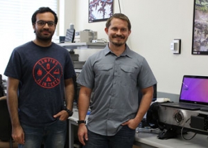
Spotlight

What Would Happen If GPS Failed?

The New Yorker featured an article on GPS: its importance in our lives and its vulnerability to spoofing attacks. Research related to GPS spoofing at the UT Radionavigation Lab was the center of attention in this write-up by Greg Milner.

“The U.S. Department of Homeland Security classifies sixteen infrastructure sectors—including dams, agriculture, health care, emergency services, and information technology—as critical, and therefore particularly vulnerable to sabotage. All but three require G.P.S. for essential functions.” … “An expert in software-defined radio—the modification of radio signals with a computer, as opposed to mixers, amplifiers, and other hardware—Humphreys used a general-purpose processor to build what he calls a “formidable lying machine,” a box that “listens” to the G.P.S. signal, gradually builds a bogus signal that aligns perfectly with the real, and then slowly overtakes it.”

Read the full story on The New Yorker website.

Austin to be the first city in the world to test precise GPS

Austin, TX — “Imagine a GPS that can place you within a centimeter of where you are located on a map. This type of accuracy would not only help keep you and your family safe, but it could potentially help drivers navigate the roads better. It’s called precise vehicle positioning and it’s 100 times more accurate than your standard GPS. University of Texas professor Todd Humphreys has been working on the project for four years.” 

The UT Radionavigation Lab is working on making Austin the first city in the world with mass-market centimeter-accurate GPS. To acquire this accuracy, 20 solar powered reference stations will be placed around Austin by the end of May. You can think of this network of 20 reference stations as smart infrastructure that make it possible to use a $50 device, instead of a $500 or $5000 device, to locate a bicyclist, a bus, or a car within its lane of travel. KXAN news covered this story featuring Dr. Humphreys and his students.

Read the full story and watch the video clip on the KXAN website.

Take a look at our latest papers on the topic:
A Dense Reference Network For Mass Market Centimeter Accurate Positioning
On the Feasibility of cm-Accurate Positioning via a Smartphone’s Antenna and GNSS Chip

Low-cost precise positioning for automated vehicles

Berkeley, CA — Dr. Humphreys delivered the Hyundai Distinguished Lecture at UC Berkeley.  The seminar series is a feature of the Hyundai Center of Excellence at UC Berkeley.  

Precise and reliable location is one of the primary challenges of vehicle automation. Driver safety demands utter reliability yet the economics of the mass market demand commodity-level costs. In his presentation, Dr. Humphreys argued that low-cost and robust centimeter-accurate satellite navigation is possible and is a must-have component of automated vehicle sensor suites. Such a system under development at the University of Texas at Austin is 100 times more precise than standard GPS and 100 times less expensive than existing precision GPS systems.

Download the presentation.

Take a look at our latest papers on the topic:
A Dense Reference Network For Mass Market Centimeter Accurate Positioning
On the Feasibility of cm-Accurate Positioning via a Smartphone’s Antenna and GNSS Chip

How Islamic Jihad Hacked Israel’s Drones

“For at least two years, the Palestinian terror group Islamic Jihad could see what the Israeli military’s surveillance drones saw. That’s the accusation of Israeli prosecutors, who this week arrested a man [Maagad Ben Juwad Oydeh] they saw hacked into the drones’ video feeds. Israeli authorities have provided only the barest details of Oydeh’s background and alleged crimes. The drone hack is possibly the most dramatic of Oydeh’s alleged crimes, if not the most useful for terrorist planners.”

Dr. Todd Humphreys and Dr. Richard Langley (University of New Brunswick) explain how Oydeh could have managed to hack the drones’ video feed, and how Israeli authorities may have come to know about it.

Read the article on thedailybeast.com.

How Secure is the Future of Mobile Positioning?

Dr. Todd Humphreys wrote an article for the February 2016 issue of IEEE ComSoc Technology News.

“Professor Todd Humphreys, an expert in the James Bond world of faking out GPS signaling, tells us what the latest news is for the reliability of the GPS systems that have become increasingly important to our everyday lives. Will GPS become the next front in the war between the modern world and the hackers and terrorists who wish to disrupt it? If so it will be engineers and not super spies who will save the day.”

Read the article on comsoc.org.

Wired Article on Drone Defenses

A recent article on Wired featured comments from Dr. Humphreys’s Congressional testimony on the threat of rogue UAVs.

“With only minor changes to [a] UAV’s autopilot software, of which highly capable open-source variants exist, an attacker could readily disable geofencing and could configure the UAV to operate under ‘radio silence,’ ignoring external radio control commands and emitting no radio signals of its own” … “Imposing restrictions on small UAVs beyond the sensible restrictions the Federal Aviation Administration recently proposed would not significantly reduce the threat of rogue UAVs yet would shackle the emerging commercial UAV industry”.

Read the article on wired.com.

UT Radionavigation Lab features in national news

The UT Radionavigation Lab featured on NBC Nightly News with Kristen Welker on October 31, 2015. The segment focused on anti-UAV techniques developed by Dr. Humphreys and his students, which have come into the spotlight following the inadvertent landing of a drone at the White House.

The news segment can be viewed at the NBS News website.

Dr. Todd Humphreys delivers keynote presentation at 2015 Texas GIS Forum

Austin, TX—Dr. Todd Humphreys delivered a keynote presentation at the 2015 Texas GIS Forum, where he talked about rendering of geo-referenced decimeter accurate maps using Low-Cost Mobile Positioning on a smartphone along with the smartphone’s camera.

This presentation focused on techniques for performing carrier-phase differential positioning using a low-quality antenna, and generation of an accurate 3-dimensional point cloud using a smartphone. The points in the generated map are geo-referenced which enables distributed generation of maps, unlike the standard computer vision techniques where a continuous sequence of overlapping images is required.

The presentation can be downloaded from here.

Dr. Humphreys talks about Low-Cost Centimeter-Accurate Mobile Positioning at Roadway Safety Institute (University of Minnesota)

Minneapolis, MN—Dr. Todd Humphreys delivered a seminar at the Roadway Safety Insititute at University of Minnesota, where he talked about Low-Cost Centimeter-Accurate Mobile Positioning with attention to application in Vehicular Networks. GNSS, along with other sensors, will be a part of the Connected (Semi-) Autonomous Vehicles of the future, and accurate location and timing via GNSS is an important aspect of roadway safety.

The primary barrier to performing centimeter-accurate carrier-phase-differential GNSS (CDGNSS) positioning on smartphones and other consumer devices is their low-cost, low-quality GNSS antennas that have poor multipath suppression. The time correlation of multipath errors and their magnitude significantly increases the initialization period of GNSS receivers using low-cost antennas.

This presentation focused on techniques for reducing the initialization time for centimeter-accurate positioning on mobile devices. It further examined technical and market prerequisites for improved safety for semi-autonomous and autonomous vehicles, globally registered augmented and virtual reality, and crowd-sourced three-dimensional mapping.

Watch the full length presentation at Roadway Safety Institute webpage.